CERTIFIED BY NITA
INTRODUCTION
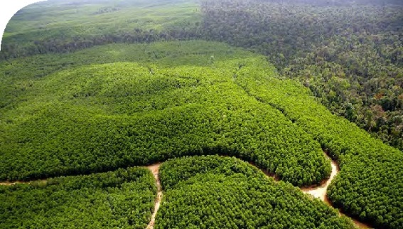
Forestry involves the management of a broad range of natural resources within a forested area. We all agree Forestry is complex, dynamic, and multidimensional. GIS technology profoundly and positively impacts the way land managers, timber managers, and forestry specialists manage timber resources. Having accurate geographical information about land is critical to making informed decisions about how to manage it. Digital maps can be linked to relational databases that store baseline data, topography information, site documentation and aerial digital photography Designing and implementing a comprehensive GIS plan is the foundation for sound forest management and wildlife management decisions. Additionally, a GIS plan is an integral part of developing a forest management plan.
Who should apply?
People who require additional skills like Forest Planners, foresters, forest conservation technicians.
DURATION
5 Days
Requirements:
No prior knowledge of GIS is required
TRAINING OBJECTIVE
At the end of these sessions participants will learn to:
• Obtain and Integrate data from disparate sources to a GIS System
• Learn the principles of GIS and Remote Sensing and its application in forestry
• Learn how to collect data using mobile phones and GPS in the forestry context
• Learn satellite digital image processing techniques in forest resource management
• Learn how to map forest inventory
• Learn how to handle emergency in the forest context
• Learn how communities can be involved in forest resource management
• Learn how to publish web based map
• Display data in 3D Apply GIS to solve simple practical problems forestry
• Learn forest planning and management skill using remote sensing and GIS
COURSE OUTLINE
Module 1:
Introduction and definitions of key concepts
Module 2:
Digital Image Processing Techniques In Forest Resource Management
Module 3:
Mapping Forest inventory
Module 4:
Forest Planning and management
Climate Change Impact on Forests
Module 5:
Participatory GIS
Case studies on use of GIS and remote sensing in forest management
How to participate
Tailor Made Training
Register Individual
Register Group
Become One of Our Partners.
View GIS and Earth Observation Institute Course Catalogue
For further inquiries, please contact us on Tel: +254 715 077 817, +254 (020) 211 3814, +254 731240802, +254 735331020.
Email [email protected]