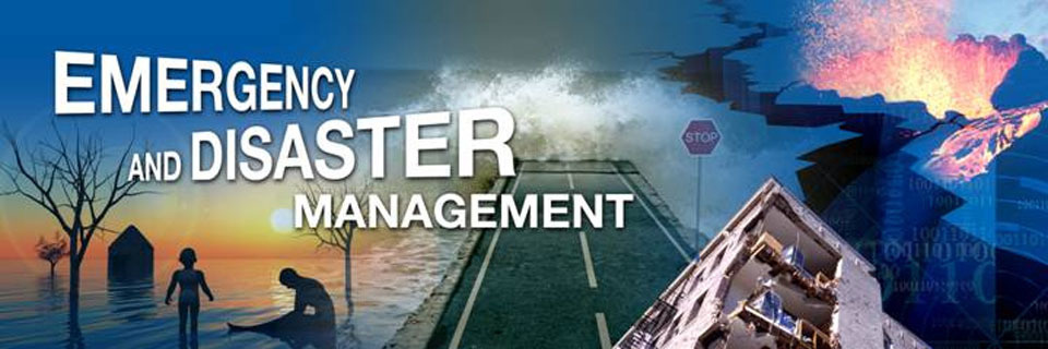
Event: Use of GIS and Remote Sensing in Disaster Risk Management Course
NITA CERTIFIED
RECENT CLIENTS
INTRODUCTION
IDisaster risk information is spatial in nature & Geographic Information Systems (GIS) play an important role in disaster risk management. Rapid population growth & urbanization combined with extreme climatic events are causing a rapid increase in vulnerability of communities exposed to hazardous events. Natural disasters inflict severe damage on almost the entire spectrum of social and natural habitats, ranging from housing and shelter, water, food, health, sanitation, and waste management to information and communication networks, supply of power and energy, and transportation infrastructure.
There is a great need to utilize disaster risk information in planning for effective coping mechanisms of disaster risk reduction. For this, there is a significant need to create awareness among the disaster management professionals regarding the importance of GIS and Remote Sensing.
This course is job oriented and aims to impact practical skills on how to use GIS and RS ,to overcome the major challenges faced in ,pre-disasters during disaster and post-disaster management such as during early warning, hazard, vulnerability and risk assessment, damage assessment, as well as in the design of risk reduction measures.
DURATION
5 Days
WHO SHOULD ATTEND
The course is targeted at professionals who require knowledge and skills on the use of GIS and RS in their organization in the field of disaster management. Participants are welcome from a broad range of organizations including physical planning, institutions, professionals and private GIS and RS related firms
COURSE OBJECTIVES
Upon completion of the course, the participants will be able to:
•Describe and utilize spatial data, GIS and remote sensing in disaster risk assessment and management
•Utilize existing sources of historical disaster information and elements at risk data
•Apply GIS/remote sensing in hazard, vulnerability and risk assessment
•Employ risk information in emergency preparedness planning
•Visualize hazard and risk information
•Apply GIS/remote sensing to post-disaster damage assessment
MODULES TO BE COVERED/TOPICS
•Basic information
•GIS data sources, data collection and integration techniques for DRM
•Hazard, vulnerability and Risk assessment with GIS and RS (Pre-Disaster)
•Application of Risk Information for Risk Reduction Planning (Pre-Disaster)
•Introduction to Early warning systems and Information Networks (Pre-Disaster)
•Disaster Impact Analysis (Post Disaster)
•Public Participatory GIS and Disaster Risk Management (Pre- and Post-Disaster)
View our website for more details
How to participate
Tailor Make A Course
Register as an Individual
Register as a Group
Become One of Our Partners.
Frequently Asked Questions (FAQ’s)
Purchase Software
View related courses
•GIS and Remote Sensing For Climate Change Impact Analysis and Adaptation Course
•GIS Analysis for Health Sector Programmes Course
•GIS and Remote Sensing for agricultural resource management Course
•GIS and remote sensing in conservancy and wildlife management Course
The most popular courses
•Establishing and strengthening farmer organizations Course
•Introduction to Occupational Health and Safety Course
•Principles and Practice of Research Data Management & Collection Course
•Knowledge Management Course
View GIS and Earth Observation Institute Course Catalogue
For further inquiries, please contact us on Tel: +254 715 077 817, +254 (020) 211 3814, +254 731240802, +254 735331020.
Email [email protected]